- What Makes Ha Giang a Photography Destination?
- Landscape scale you cannot fake
- Clouds are part of the composition
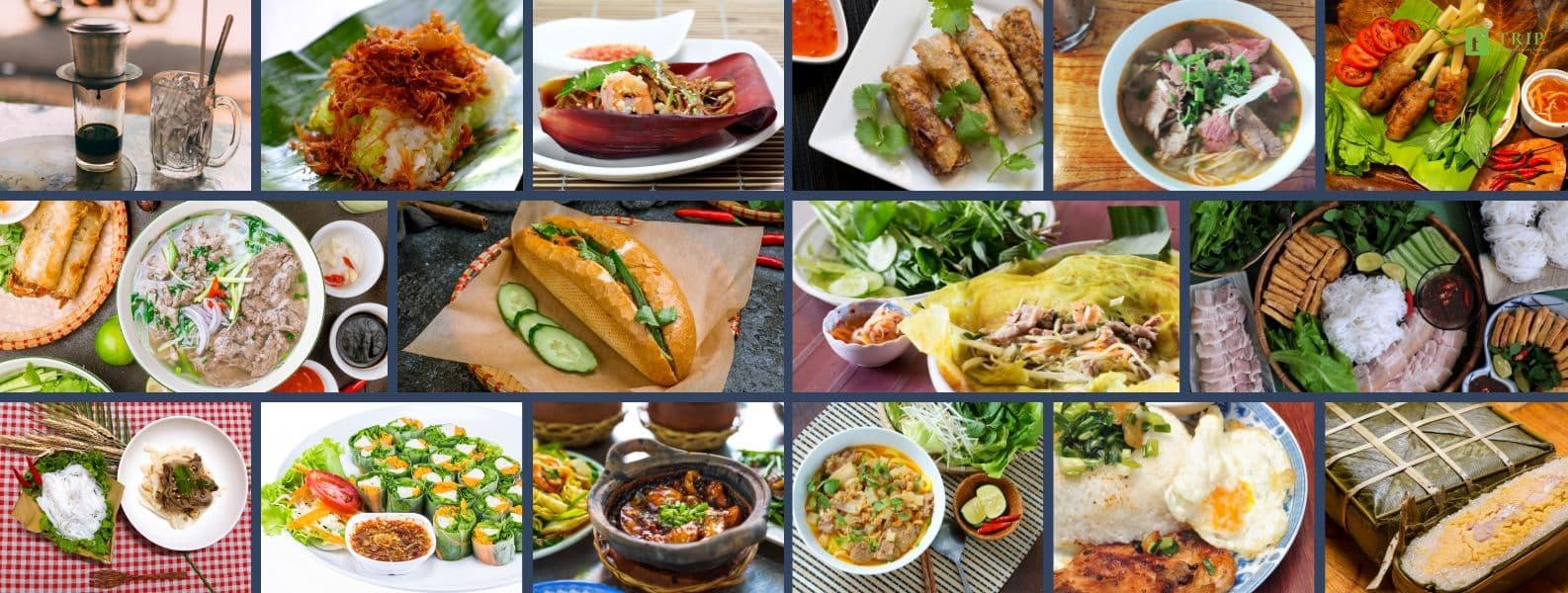
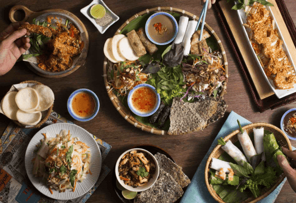
- Culture adds the missing half of the gallery
- Choose Your Photo Goals Before You Go
- Epic landscapes
- Cultural documentary
- Motion and adventure
- Best Time to Shoot the Ha Giang Loop
- Best seasons for photographers
- Rainy season reality
- Daily light strategy
- Must-Shoot Locations on the Ha Giang Photo Map
- Quan Ba Heaven Gate
- Dong Van Karst Plateau
- Ma Pi Leng Pass and the Nho Que River gorge
- Bonus detail stops
- Camera and Gear Checklist
- Minimum kit
- If you are serious about landscapes
- Ride-safe extras
- Itinerary Designs Built for Light, Not Speed
- 3D2N: short, cinematic, intense
- 4D3N: best photography pace
- 5D4N: creative slow travel
- Logistics That Protect Creativity
- Start early
- Sleep for the light, not just the bed
- Permits and checkpoints
- Safety and Ethics
- Photography safety on mountain roads
- Respectful portrait practice
- A Simple Editing Workflow
- FAQs
- What is the best time to do the Ha Giang Loop for photography?
- Is 3D2N enough for a photography-focused Loop?
- What are the best viewpoints for Ma Pi Leng Pass photos?
- Do foreigners need permits for checkpoints on the Ha Giang Loop?
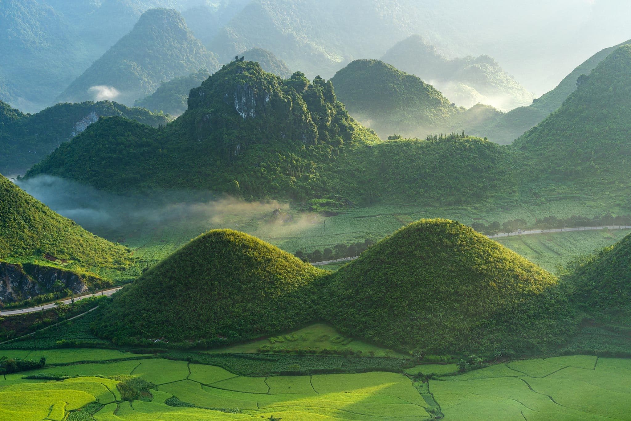
- What is the Dong Van Karst Plateau UNESCO Global Geopark?
- Conclusion
Ha Giang is where Vietnam starts to look surreal. The landscape shifts from green valleys into sharp limestone walls, high ridgelines, deep river gorges, and roads that seem suspended in the sky. Much of that visual drama sits inside the Dong Van Karst Plateau UNESCO Global Geopark, which UNESCO recognizes in Ha Giang Province and which Vietnam Tourism places at the heart of the Loop experience.
A strong Ha Giang Loop photography trip is not about ticking off stops. It works best when it is designed around light, energy, and story. For most photographers, the best pacing is 4D3N, while 3D2N can still work if you protect your major shooting windows. The most reliable seasons for clear layers and comfortable conditions are usually spring (March–May) and autumn (September–November), while foreign travelers are commonly advised to carry a border travel permit for checkpointed sections of the route.
What Makes Ha Giang a Photography Destination?
Landscape scale you cannot fake
Ha Giang has the kind of terrain that naturally creates strong compositions: limestone massifs, vertical valleys, cliff roads, and dramatic negative space between sky and rock. The Dong Van Karst Plateau is especially important here, because it gives the region its visual identity: bare stone, sharp geometry, and long road lines cutting through mountain forms. UNESCO and Vietnam Airlines both describe the plateau as one of Asia’s major limestone geopark landscapes.
Clouds are part of the composition
In Ha Giang, fog and clouds are not problems to avoid. They are tools. Fast-moving weather can soften ridgelines, hide and reveal valleys, and turn ordinary views into layered, atmospheric frames. That is one reason spring and autumn are so valuable: they tend to give you a better balance between clarity and mood than the rainier months.
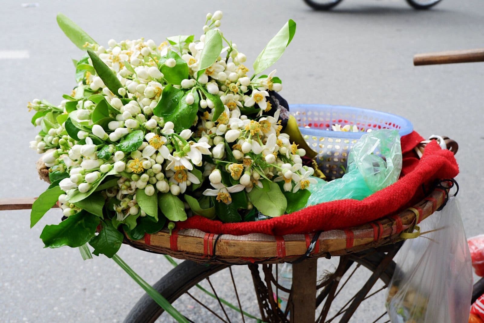
Culture adds the missing half of the gallery
A good Ha Giang gallery is not only landscapes. Markets, textiles, roadside tea stops, homestay interiors, hands at work, and small-town details are what make the set feel like Ha Giang instead of just “mountains somewhere.” Vietnam Tourism’s Loop material emphasizes local markets, roadside stops, and town life as part of the route’s appeal, not separate from it.
Choose Your Photo Goals Before You Go
Epic landscapes
This is the most obvious creative track: ridge roads, high passes, gorge overlooks, and wide frames where the road acts as a leading line. Ha Giang is unusually good for this because so many viewpoints combine altitude with strong road geometry.
Cultural documentary
This works best in markets, homestays, village lanes, and meal stops. The strongest images are usually not posed portraits, but moments of movement, work, conversation, and texture. Ask before close-up portraits.
Motion and adventure
This is where the Loop becomes more than scenery: convoy silhouettes, mirrors reflecting sky, road curves shot with compression, helmets against cloud, and road motion used carefully. These shots should always come second to safety.
Best Time to Shoot the Ha Giang Loop
Best seasons for photographers
The most commonly recommended photography windows are March to May and September to November. These periods are widely favored for more comfortable temperatures, stronger visibility, and more dependable road conditions. Autumn also adds golden rice-field color in some areas, which makes the landscapes feel richer on camera.

Rainy season reality
Rainier months can be lush and moody, but they are harder to plan around. Reduced visibility, slippery roads, and shifting schedules can easily erase your sunrise or pass timing. That does not make the season useless for photography, but it does make it less reliable for a photography-first trip.
Daily light strategy
The simplest rule is still the strongest:
-
Sunrise to mid-morning: best chance for clearer layers and softer contrast
-
Golden hour: protect your hero location if possible, especially Ma Pi Leng
-
Midday: switch to culture, detail, interiors, food, and black-and-white-friendly contrast scenes
This matters because mountain weather builds fast, and the best wide views are often strongest before later cloud or haze develops.
Must-Shoot Locations on the Ha Giang Photo Map
Quan Ba Heaven Gate
This is one of the best “opening statement” locations for a Ha Giang photo story. It gives you scale, valley depth, switchback roads, and the sense that you are entering a different world. It is also commonly described as the gateway to the Dong Van Karst Plateau.
Best for: establishing shots, broad valley panoramas, road-leading-line frames, early atmospheric light.
Dong Van Karst Plateau
This is the texture and geology zone. Instead of one single hero overlook, this part of the Loop gives you repeated opportunities for minimalist frames, layered stone ridges, road cuts, and wide skies over hard limestone forms. UNESCO’s recognition is a useful reminder that this is not just scenic ground; it is globally significant terrain.
Best for: geology-driven compositions, long-lens mountain layers, negative-space landscapes, road-versus-rock framing.
Ma Pi Leng Pass and the Nho Que River gorge
This is the signature cinematic set. Vietnam Tourism’s Ha Giang Loop guide treats this section as the most dramatic part of the classic route, and it is easy to see why: one of the region’s most famous ridge roads hanging above the Nho Que River gorge.
Best for: hero landscapes, telephoto compression, ridge-road compositions, vertical frames with river depth, layered golden-hour scenes.
Bonus detail stops
High-return, lower-hype frames often come from:
-
market mornings
-
homestay interiors
-
roadside tea stops
-
hands, fabrics, tools, and meals
-
bike details against a huge background
These are the shots that make the final set feel complete.
Camera and Gear Checklist
Minimum kit
For most travelers, this is enough:
-
phone plus one camera body
-
a standard zoom like 24–70mm equivalent
-
a small tripod
-
a polarizer
-
dry protection and lens cloths
This setup covers most of what the Loop throws at you without becoming a burden on the bike.

If you are serious about landscapes
A stronger photography setup adds:
-
a wide lens for ridges and pass drama
-
a telephoto for mountain layers and road compression
-
extra batteries and memory cards
You will shoot more than you expect. Cold mornings, fog, and long days also drain batteries faster than many people plan for.
Ride-safe extras
Bring:
-
a dry bag
-
microfiber cloths for mist and dust
-
waterproof phone protection
-
a power bank
These matter because cloud, dust, and road spray are normal parts of the Loop.
Itinerary Designs Built for Light, Not Speed
3D2N: short, cinematic, intense
Day 1: Ha Giang City → Quan Ba → Yen Minh
Use this as your warm-up and scouting day. Do not overshoot. Save energy for the next day.
Day 2: Yen Minh → Dong Van → Ma Pi Leng → Meo Vac
This is the hero day. Protect your major landscape window and avoid spending too much time early on smaller stops.
Day 3: Meo Vac → return toward Ha Giang City
Use this as the detail day: slower returns, small-town shots, market timing if possible, and missed frames from earlier.
This works if you are disciplined. It is short, but still capable of producing a strong set.
4D3N: best photography pace
This is the better version for most creative travelers.
Day 1: Ha Giang City → Quan Ba → Yen Minh
Scout, settle in, and use the golden hour carefully.
Day 2: Yen Minh → Dong Van
Make this your texture and culture day: karst plateau forms, small-town scenes, detail shooting.
Day 3: Dong Van → Ma Pi Leng → Meo Vac
This is the true hero pass day. Protect it.
Day 4: Meo Vac → Ha Giang City
Use it as a flex day for missed light, market scenes, or weather recovery.
A 4D3N pace usually creates the strongest gallery because it leaves room for weather and story, not just transport.
5D4N: creative slow travel
Add one more sunrise mission and one culture-focused half day if you want a set that feels less like a trip recap and more like a personal project.
Logistics That Protect Creativity
Start early
Early starts buy you options. They make it easier to catch layered light, keep pace relaxed, and avoid turning every hero shot into a rushed roadside stop.
Sleep for the light, not just the bed
Choose overnight bases based on your next morning’s shooting plan. The right base is the one that protects your sunrise or pass timing, not necessarily the most comfortable room.
Permits and checkpoints
Foreign travelers are commonly advised to carry a border travel permit on the classic Loop because sections of the route pass through regulated border-region districts and checkpoints may ask for it. Ask your operator or accommodation whether they arrange it, and keep your passport or copy ready.
Safety and Ethics
Photography safety on mountain roads
Never set up a tripod on blind curves or in unsafe roadside positions. Do not chase a drone shot or a pass angle in dangerous wind or low-visibility conditions. Missing the shot is always better than creating the accident.
Respectful portrait practice
Ask first. Show the image afterward when appropriate. Avoid treating villages like open-air photo sets. The Loop feels richer when the photography is respectful rather than extractive.
A Simple Editing Workflow
To keep your set coherent, sort into three folders:
-
Hero Landscapes
-
Culture
-
Details
Then build a final gallery of about 12 to 20 images:
-
40% landscapes
-
40% culture
-
20% details
Keep one consistent treatment in contrast and color temperature so the gallery feels intentional instead of mixed from different moods.
FAQs
What is the best time to do the Ha Giang Loop for photography?
Usually March to May and September to November for the best balance of visibility, comfort, and road conditions.
Is 3D2N enough for a photography-focused Loop?
Yes, but it is intense. 4D3N is better because it gives you more room to protect light and recover from weather.
What are the best viewpoints for Ma Pi Leng Pass photos?
The strongest results usually come from the Ma Pi Leng ridge section itself and the broader viewpoints above the Nho Que River gorge, where you can combine road, depth, and layered mountain forms.
Do foreigners need permits for checkpoints on the Ha Giang Loop?
They are commonly advised to carry a border travel permit for the classic route because checkpoint checks can happen in regulated border districts.
What is the Dong Van Karst Plateau UNESCO Global Geopark?
It is a UNESCO-recognized geopark in Ha Giang Province known for its limestone karst landscapes, geological heritage, and dramatic plateau scenery.
Conclusion
A Ha Giang Loop photography trip works best when it is built around light, energy, and story. Go in spring or autumn for the highest odds of clear layers, choose 4D3N if you can so the route has room to breathe, and protect Ma Pi Leng as your hero landscape segment.
Most importantly, shoot beyond the obvious. The mountains are the draw, but the markets, fabrics, pauses, and roadside human details are what make the final gallery feel like Ha Giang rather than just “epic scenery.”


Founder & Photography Guide
Specialties: Culture, landscape, portrait, hiking, active and adventurous tour
Besides my unlimited passion for traveling, a professional tour guide for over a decade, I have been taking photographs since sitting at Hanoi of the University of Culture in the early 2000s. Photography started as a hobby but it was seriously taken due to my work relations and my significant passion for the beauty of our world, especially in Southeast Asian parts such as Vietnam, Laos, Cambodia, and Myanmar.
Within a few years of taking photographs, my works began to be recognized by many reliable international publications such as AFAR Travel, The Times, and The Daily Telegraph newspaper. In addition, I continuously add to my growing profile by winning numerous major awards: 3rd Position of The Independent Photographer 2018, 1st Position of Amateur Photographer of the year 2018, Grand Prize Winner of the AFAR Travel Photography 2019, and a Gold Award of San Francisco Bay International Photography 2020.
I photograph a wide variety of subjects, from travel to landscapes to street scenes. I enjoy documenting the East’s rich cultural heritage and its land soaked in glorious sunrise or sunset light in remote and secluded spots. And, I am very happy to share my knowledge and experience with you. You can visit Luminousvietnamtour to explore tour!